Information
Departure on a regular flight to Santa Cruz de la Palma , capital of Isla Bonita. Arrival, reception and transfer to the hotel. Rest of the day free to make a first contact with the island.
Accommodation.
Breakfast. This day we will make the route of La Cima de la Isla, where we will have the best views of La Palma, the Caldera de Taburiente and the beautiful island.
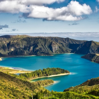
The walk is of medium difficulty, mainly due to the height, since we walk above 2,000m in the Roque de los Muchachos area . The trail runs along the rim of the crater throughout the day, looking into this impressive erosion crater or towards the northern part of the island, which is often covered in a white blanket. We will be able to appreciate the chain of volcanic craters in that area, La Ruta de los Volcanes . At the end of the route, at Pico de la Cruz , we will make a stop to enjoy the landscape for the last time and be able to take more photos of La Cima de la Isla and the Observatories.
Accommodation.
Distance: 6 km
Time: 3.5 hours
Slope: +150m, -300m
Breakfast. Today we will go to La Caldera de Taburiente, one of the largest erosion craters in the world. After crossing the Barranco de Las Angustias, a winding track leads us to Los Brecitos (at 1,081 meters above sea level), where we will begin the route. The beginning section is very easy, with practically no rocks on the trail. About three hours later we will arrive at the center of La Caldera de Taburiente, where the amount of water that this crater collects is such that it seems that we are in other latitudes. We are in the center of the national park surrounded by high mountains, a perfect place for lunch. The most daring can take a bath in the Taburiente ravine. Then the trail gets lost among the rocks and we begin an intense descent of approximately 1km that will put us to the test. The Barranco de las Angustias full of water will be our exit route and the last stretch of trail until the end of our route.
Accommodation.
Distance: 16 km
Time: 6 hours
Slope: -850
Breakfast. We will do the walk of the springs of Marcos and Cordero . We will go up by vehicle to Casa del Monte at 1,300m, passing through the small village of Las Lomadas, with its little houses attached to the road full of orchards where everything seems to grow. There, we will have a few minutes to get ready, pick up our helmet and flashlight to enjoy this route. We will walk along the side of the old canal to the bowels of the ravine of the water, an area where we will walk throughout the day. We will go through 13 tunnels full of surprises and anecdotes, wide enough to go through without much trouble, although you have to bend down and dodge stones on the way. After reaching the first and colorful spring of Marcos, we will be able to see how the water flows from the rock in large quantities and we will access the second spring of Cordero where we will eat something, in a very quiet place.
The part of the walk to Los Tilos will put us to the test with a descent of 1000m in 8km. The first part of the descent takes us to the bottom of the ravine, to then take us to the deepest parts of this protected area. We will enter the Los Tilos forest and go to the Espigón viewpoint to photograph this wonderful protected area and face the last section of the walk.
Accommodation.
Distance: 12 km
Time: 5 hours
Slope: +150m, -1000m
Breakfast. Today's route will take us through the far north of the island , dotted with ravines with views of the blue sea rarely seen. The paved path, an authentic royal road that has been preserved as if time had not passed by, crosses the Barranco de la Vica which leads us to La Palmita, crossing remote enclaves of enormous beauty and small rural towns full of peace and taste of yesteryear
Accommodation.
Distance: 4.5 km
Time: 6 hours
Slope: +3000m, -550m
Breakfast. Today we will make a spectacular and impressive route that runs from the Refugio del Pilar (1450m) along the GR 131 crossing old and recent volcanic cones to the south to the town of Los Canarios.
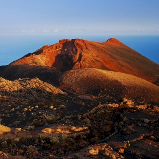
Accompanied by breathtaking landscapes such as the lava fields of the San Juan Volcano (eruption in 1949) until our ascent conquers the highest crater in the entire mountain range: Las Descadas. From there we dominate the island from the air, even seeing the neighboring islands of Tenerife, La Gomera and El Hierro.
On our descent, a beautiful volcano with intense colors still appears: the Martín volcano . Afterwards, everything is descending between pine forests until the town of Fuencaliente comes to surprise us and puts an end to our march.
Accommodation.
Distance: 17.1 km
Time: 7 hours
Slope: +500m, -1,200m
Breakfast. Today we will have the day off to enjoy the charms of the island or take optional excursions. We recommend taking a walk through the historic center of the capital, its colonial-style houses with carved wooden balconies give the streets a colorful air.
Accommodation
Breakfast. Free time until the time of transfer to the airport to catch the return flight.
La Palma: Hotel Las Olas 4* (Los Cancajos)
online reservations
online reservations
Can't find what you were looking for? Create your own experience. We design a completely different trip and adjusted to your taste.
 684454342

